CONSERVATION CORNER
A weekly blog for all things conservation
 By: Tori Bristol, Dirt Gravel & Low Volume Roads Specialist
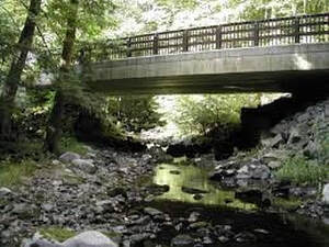
Stream crossing culverts and streams have been one of the major hot topics over the past decade. Here in Bradford County there are more than 1,000 road-stream intersections, or stream crossings, with many of those crossings being severely undersized. We depend on these crossings to safely pass roadways over streams or even rivers. We also depend on healthy waterways for clean water, recreation and other benefits. We are currently learning more and more about the relationships between stream crossing designs and the effect they have on the natural system.
0 Comments
 By: Joe Quatrini, Technical Team Leader, BCCD
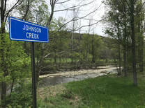
Mud Creek, Fall Brook, Bull Run, the list of stream names goes on and on, but have you ever given any thought to how streams get their names? First off, what’s the difference between a stream, creek, brook, run, or river anyway? Well, nothing really. The terms stream, creek, brook, or run generally refer to smaller free flowing bodies of water. Many people may consider a brook or run to be smaller than a stream or creek. Whereas, the term river is used for larger bodies of flowing water, however, at their headwaters (where they start) they are often small as well. For example, here in Bradford County, we are familiar with the Susquehanna River and recognize it for its size (width, depth). Near its headwaters in Cooperstown, NY though, the Susquehanna is no bigger than many of our smaller streams. 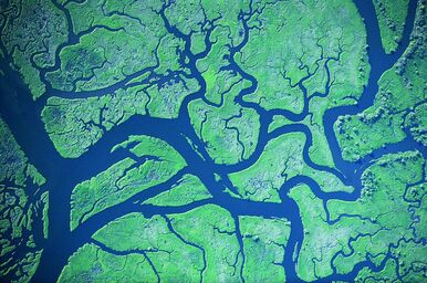 By: Joe Quatrini, Technical Team Leader, BCCD
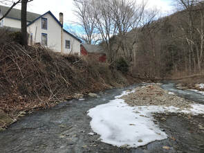
Last week you read about watersheds and hopefully that got you thinking about how our actions locally impact streams and other waterbodies nearby and even regionally. Today, we’ll narrow our focus a bit to discuss stream order. Simply put, stream order categorizes streams by their size. There’s a little more to it than that, however, its relatively uncomplicated. There’s a basic numbering system: First Order, Second Order, Third Order, and so on, that describes a stream and its position relative to other streams in a watershed. A first order stream is a ‘headwater’ stream or a stream that originates from a spring, a wetland, or a pond, etc. You may have a wet spot in a field on your property and as that spot drains downhill it starts to concentrate, picks up speed, and creates a channel with a defined bed and banks. This would be a first order stream. Sometimes what might complicate this is if someone digs a ditch across their property and after some time, it appears to be a stream and may be categorized as such. This is where some landowners may encounter issues with state or federal agencies if they try to alter or maintain that ‘ditch’ once stream characteristics start to develop. If you’ve been following this column over the last couple years, you’ve read over and over that usually the best option when dealing with water is to let it spread out and not to concentrate it. This adds another dimension to that argument where your initial solution to a problem has created a new problem for you now. 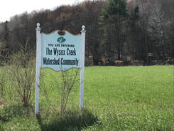 By: Joe Quatrini, Technical Team Leader, BCCD
What is a watershed? For some reading this article, a definition or explanation may be easy to come by either due to where you live, your profession, or what your hobbies may be. For others, maybe it’s a word you hear on the nightly news or on social media around discussions led by the Environmental Protection Agency (EPA) and regulations associated with the Chesapeake Bay. Or maybe this is the first time you’ve heard it. 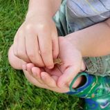 By: Jonathan VanNoy, Natural Resource Specialist
What do you consider to be the “official sign” that spring has arrived? During daylight hours, many observe the first Robin of the year to be the sign that spring has sprung, or at least that winter’s grasp is weakening. Other examples are the emergence of flowers such as Snowdrops, Crocus, or Daffodils. However, one of the most prominent (and my personal favorite) sign of spring is the cheery chorus of the Northern Spring Peeper! 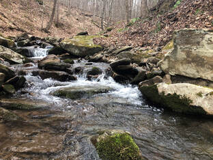 By: Cathy Yeakel, District Manager, BCCD
Pennsylvania and neighboring states are working at local levels to clean up our state’s waterways that flow into the Chesapeake Bay. In 2019, the Pennsylvania Department of Environmental Protection (DEP) submitted the Phase III Watershed Implementation Plan (WIP), which established tangible nutrient reduction goals based on locally-led initiatives to reduce water pollution, improve quality of life, address flooding problems, and obtain credit for previously installed best management practices. Within the Phase III WIP, all 43 Pennsylvanian counties within the Chesapeake Bay watershed were tasked with developing their own Community Clean Water Action Plan (CAP). 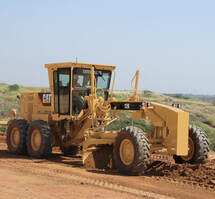 By: Tim Robson, Dirt and Gravel Road Specialist
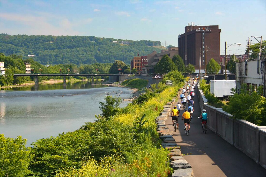
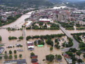
This week’s column will be the first of four articles presented throughout the year focusing on municipal road maintenance. I’ll try to explain what you might see going on in your township or borough each season and why. I know many have wondered: why are they doing what they’re doing to my dirt road? Although every crew does things slightly different, general tasks are consistent around the county. I will simply explain the process from my view as a former Road Foreman and current Dirt and Gravel Road Specialist here at the Bradford County Conservation District. For this first article, we will focus on the upcoming spring maintenance season. By: Ad Crable, Staff Writer, Chesapeake Bay Journal The Susquehanna River has the most flood prone basin east of the Mississippi. And Binghamton, NY, located entirely in a floodplain at the confluence of the Susquehanna and Chenango rivers and downhill of steep, flash-flooding watersheds, might be its most pummeled victim. But now, after the twin punches of an all-time record flood in 2006 followed by an even more devastating 500-year flood only five years later, officials have decided to quit fighting its rivers and instead rebuild to roll with the punches.
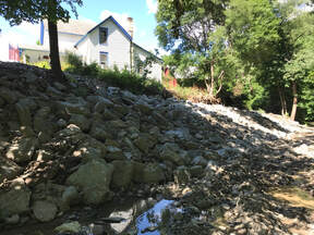
By: Joe Quatrini, Technical Team Leader, BCCD Recently, the Bradford County Commissioners made a huge commitment to watershed rehabilitation. Using money from the Act 13 Unconventional Gas Well Fund, the Commissioners have dedicated $200,000 per year toward the restoration of streams to reduce erosion, prevent property loss, protect infrastructure, and improve flood resilience. Building off past successes of the County Stream Initiative program, the commissioners are entrusting BCCD with the administration of these new funds. The funds will be utilized in three critical stream areas: stream stabilization, emergency stream response, and to further the Bradford County stream pilot program. Currently, the Commissioners have designated $110,000 to stream stabilization, $75,000 to emergency stream response, and $15,000 to the stream pilot program. Hopefully, this funding will last for years to come and significant natural resource restoration can be accomplished.
 By: Kevin Brown, Agricultural Resource Specialist
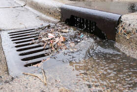
Ok, let’s get down to the brass taxes. What is a rain tax, where is it happening, and what can I do to help the situation without going to that extreme? Who wants to be taxed for rain falling on their property? “We don’t have control over that” is what they say, but we DO have control over what happens to it from there. Can you imagine Towanda (or insert your community here) before it was Towanda? Especially because it is built on a side hill. One thousand years ago a 2-inch rainfall event happened, and all that rain went into the ground. The river level was unaffected. The rainfall gradually moved through the soil layers and the excess was released into the river days or weeks or even months later. The result, no flooding. Picture it during the next 2-inch rainfall that we get. Rain hits your home, it hits the streets, it hits the schools and businesses. In some places there are no places whatsoever for it to infiltrate into the ground. It goes from your downspout to the curb, dumped into the street, adds to the water already running down the street, hits the storm drain and goes DIRECTLY to the river. The result, billions of gallons of water now going down the river that never made it there before. And it is going there like NOW. Add that to water coming from Sayre and Waverly and Athens and Chemung and Binghamton and Owego, etc. The town fathers didn’t think about this when they set up some of the systems, but as more and more communities grow, they are thinking about it now. Now we have a huge problem. We have concentrated all that water and sent it downstream (along with it- pollution, erosion, sediment, nutrients, etc.). Again, do we care enough to try and fix it one house at a time? Or do we institute a (wait for it…) Stormwater Fee (RAIN TAX)? NNNOOOOOOOO!! |
AuthorsVarious staff at the Bradford County Conservation District Archives
April 2024
Categories
All
|
|
Bradford County Conservation District
Stoll Natural Resource Center 200 Lake Road, Suite E | Towanda PA 18848 Phone: (570)-485-3144 |
Find Us on Social Media!
|
 RSS Feed